Thursday Evening Northland Forecast: 12/12/2024
One More Frigid Night
We have been enjoying mid-January cold temperatures the last few days, and it’s not quite mid-December yet. In fact, the normal high and low temp for today is 26 and 11. We had a high of -3, and a low of -18. Yikes! The record low maximum for today is -5 (set in 1922). We only missed it by 2 degrees! The record low for today is -23 (set way back in 1879), so me missed that by a mere 5 degrees. So, yes, it has been really cold recently! The coldest windchill today was -39, and that was at 8am this morning. I’m ready for a warmup, back to at least average temps. And, we will start that, right after one more night of the cold stuff.
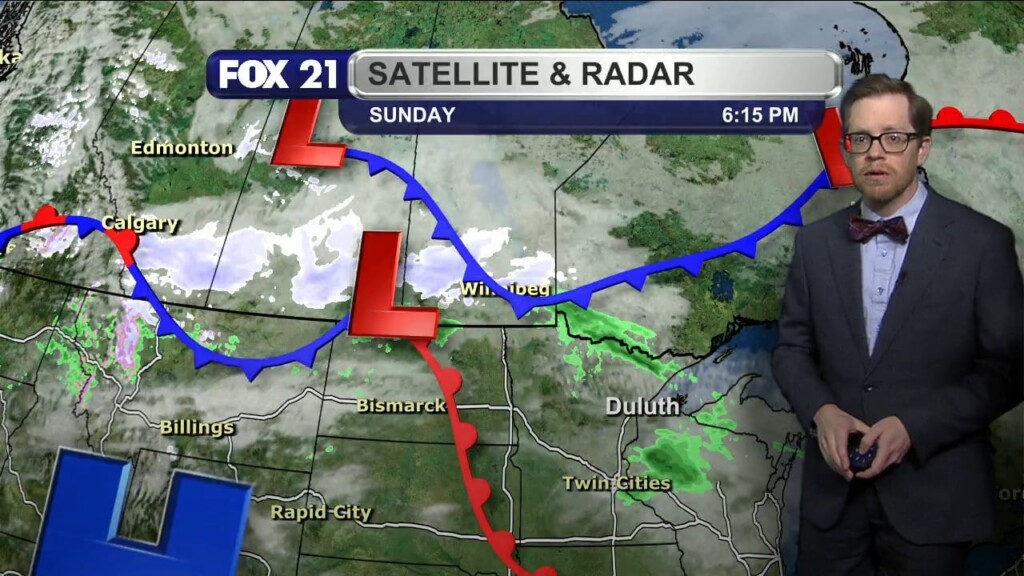
The arctic high pressure system we’ve had right on top of us will slowly move to our east overnight, and on the back side, we will get southwest winds that will significantly warm us up for the weekend. How does 34 sound for Sunday? 34 ABOVE zero! Sounds good to me! Sunday will also be the nicer day of the weekend, as we have a chance for light snow and freezing drizzle on Saturday, with a high of 28. Back to work on Monday, we will have a chance for snow or rain mixed (how weird does that sound?), with a high of 33. Then, we will cool down into the workweek, with highs back to around 20. Which still sounds better than the -18 we had this morning!
So, hang in there! Just one more cold night….for this cold snap!
FOX 21 Meteorologist Karl Spring